• UX Projects
  • Intuit
  • SoCCs App
  • AI's website
  • Waze App
  • Not your ordinary milk
  • MAP DESIGN
  • Incongruent Triangle, North Carolina
  • Kaashi
  • DDS vulnerability scale
  • Living with water, NYC
  • Water infrastructure, Varanasi
  • Oaxakeepsie
  • Terrain and Flow Mapping: Jordan River Valley
  • Rio Seco, El Alto, Bolivia
  • Thriving edges, Hunt's Point, Bronx
  • Change Mapping: Houston, TX
Computational Design
Urban Design Projects
Architecture Projects
About
  • UX Projects
  • Intuit
  • SoCCs App
  • AI's website
  • Waze App
  • Not your ordinary milk
  • MAP DESIGN
  • Incongruent Triangle, North Carolina
  • Kaashi
  • DDS vulnerability scale
  • Living with water, NYC
  • Water infrastructure, Varanasi
  • Oaxakeepsie
  • Terrain and Flow Mapping: Jordan River Valley
  • Rio Seco, El Alto, Bolivia
  • Thriving edges, Hunt's Point, Bronx
  • Change Mapping: Houston, TX
Computational Design
Urban Design Projects
Architecture Projects
About

Change Mapping: Houston, TX

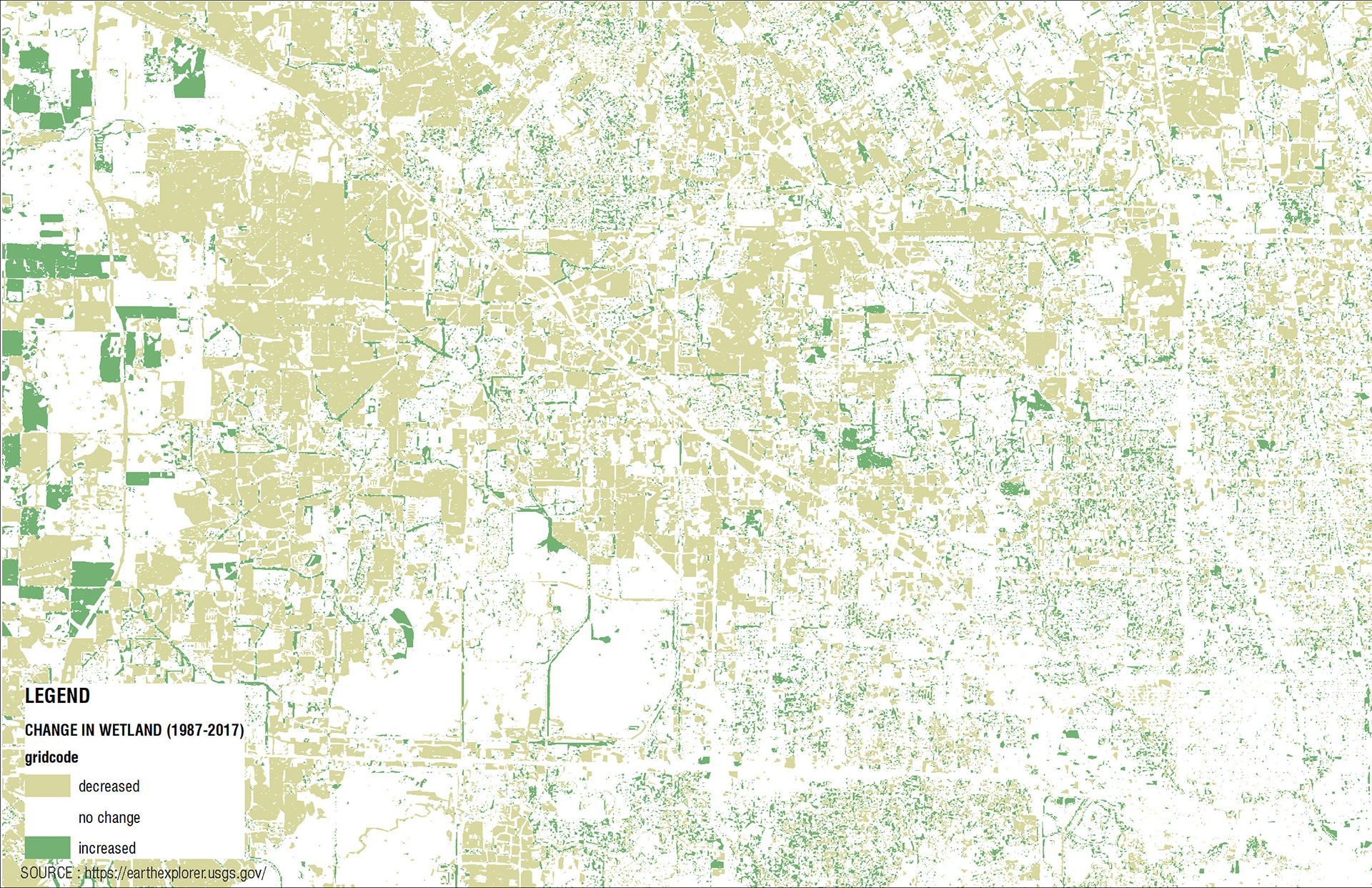
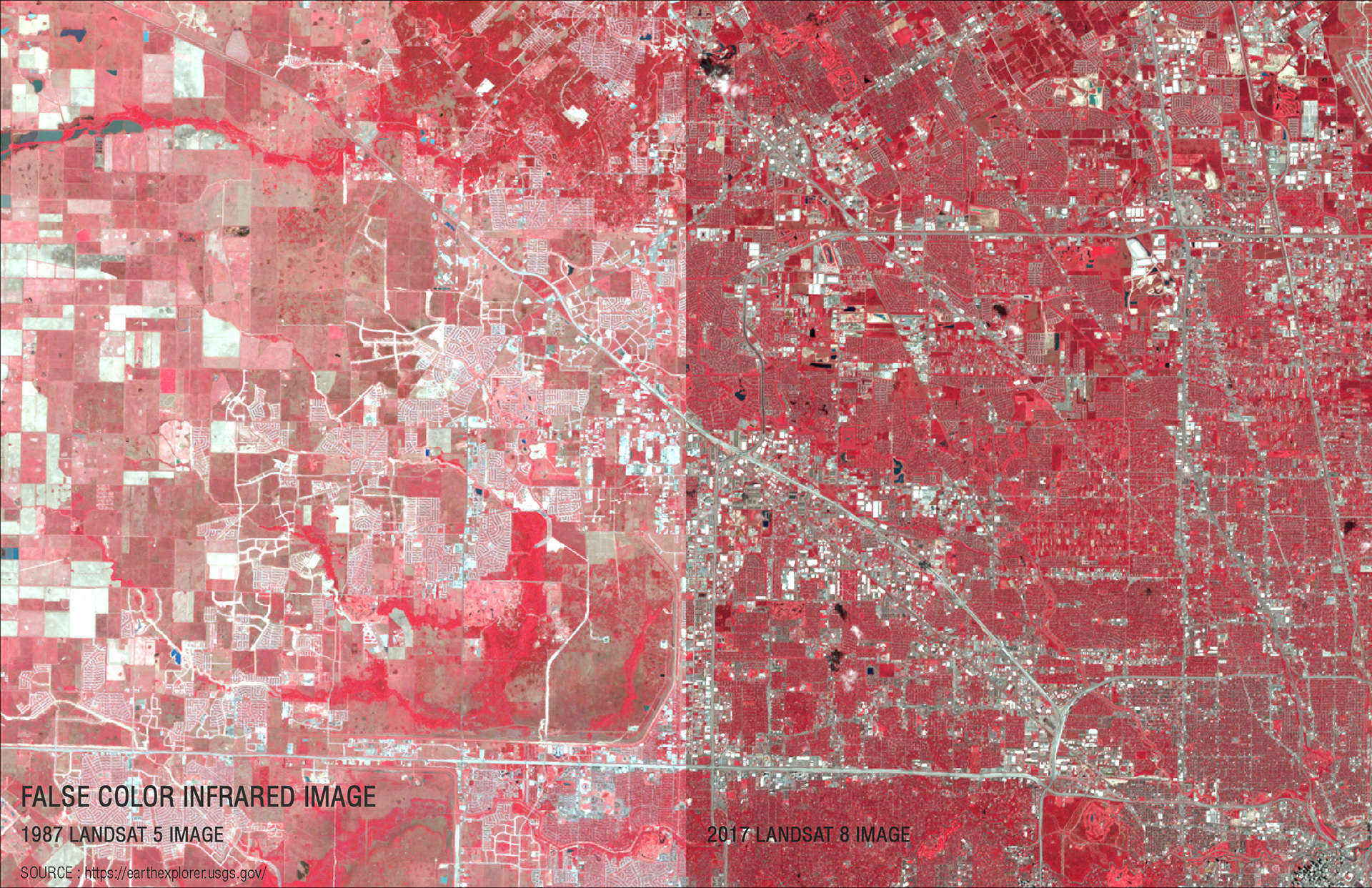
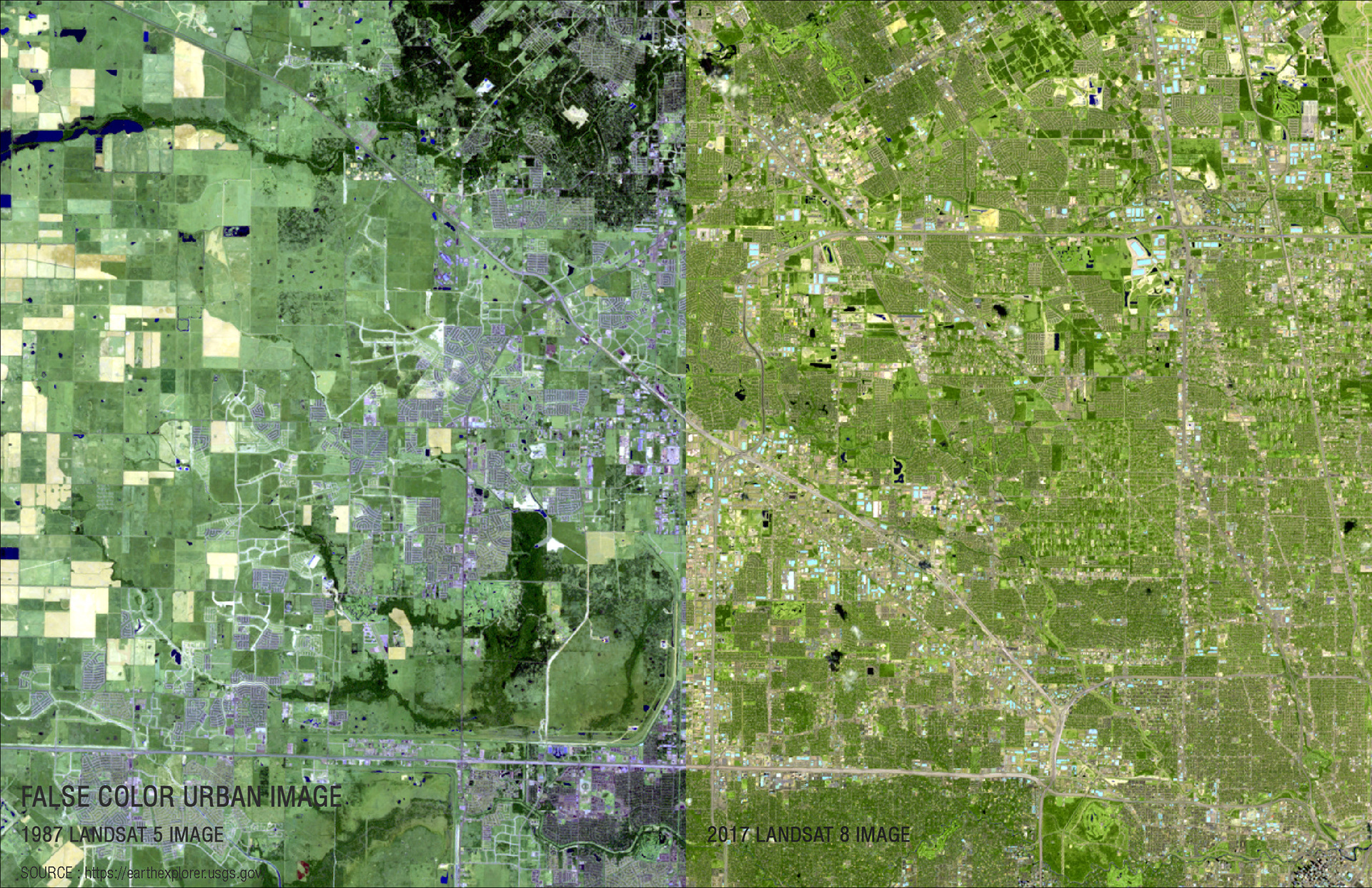
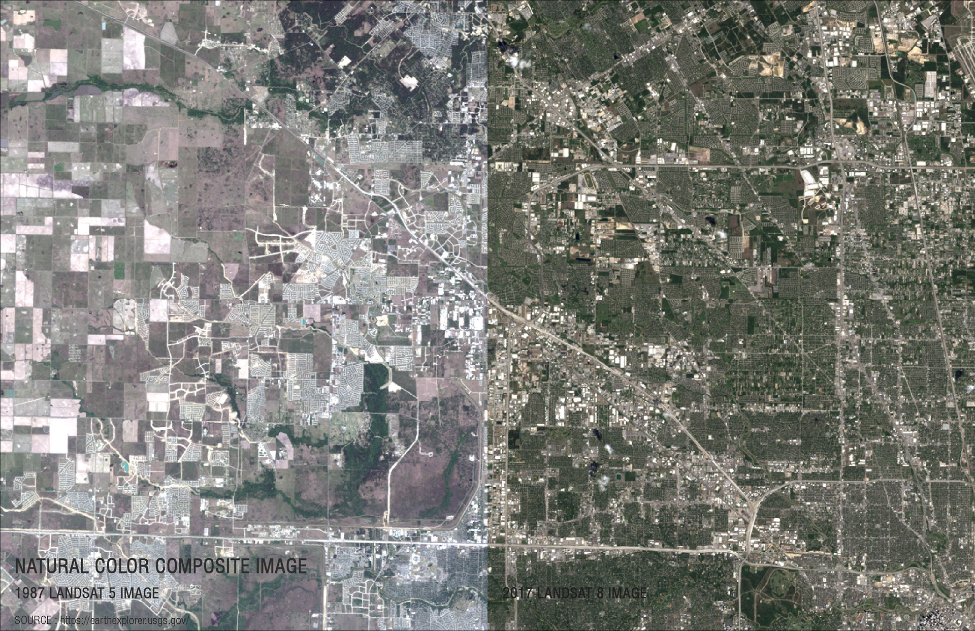
Using false color satellite imagery, and referring to this Texas A&M University study as a springboard, we will visualize and measure the loss of wetlands in Houston, TX, between 1987 and 2017

↑Back to Top
Powered by Adobe Portfolio